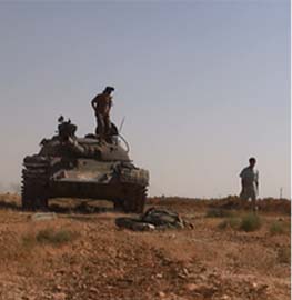
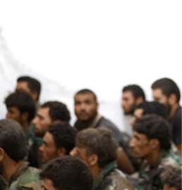
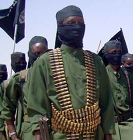
The Pakistani military and the Taliban have skirmished throughout the war-torn northwest over the past several days. Clashes in South Waziristan, Bajaur, and Hangu have reportedly killed 46 Taliban fighters and 12 soldiers.
In South Waziristan, where the Army has launched an offensive against the Movement of the Taliban in Pakistan in the Mehsud tribal areas, the military claimed success over the weekend after retaking the town of Kotkai. The town is the birthplace of Taliban commander Hakeemullah Mehsud and the hometown of suicide bomber trainer Qari Hussain Mehsud.
The Army first took Kotkai on Oct. 19 but lost it the next day in a Taliban counteroffensive. The Taliban claimed to have killed upwards of 45 soldiers in the battle, but the Army denied the report.
The military now says it has advanced a mile past Kotkai in its push toward the town of Sararogha, one of the main strongholds of the Taliban. Thirty-four Taliban fighters and six soldiers have been reported killed during fighting since Sunday.
The military is advancing on three fronts to reach the towns of Makeen, Ladha, and Sararogha. More than 30,000 Pakistani soldiers are battling an estimated 10,000 Taliban and 1,500 allied jihadis for control of South Waziristan.
Hangu
In Hangu, the military claimed 16 Taliban fighters were killed in the Tora Warai region. “Hundreds of militants of Tehrik-i-Taliban Pakistan [Movement of the Taliban in Pakistan] from Arakzai Agency and no-go areas of Hangu took part in the attack” on a security outpost, Dawn reported. One security official was killed in the assault.
The military also said that in addition to the Taliban killed, 23 Taliban were wounded and 54 more were captured during a counterattack.
The Taliban use the Tora Warai region in Hangu to move into neighboring North Waziristan, Dawn reported. Last weekend, the military destroyed a road in the region in an attempt to halt the flow of Taliban fighters from Arakzai through Hangu into North Waziristan.
Before commencing the present operation, the military signed an agreement with North Waziristan Taliban commander Hafiz Gul Bahadar to keep his forces from attacking military convoys and to not allow the Movement of the Taliban in Pakistan to transit through the region. The move by the government to destroy the road indicates, however, that the Taliban are still transiting through North Waziristan to fight in South Waziristan.
Bajaur
In Bajaur, the Taliban struck back against the military, which has been conducting an operation in the region. Four soldiers were killed in an ambush in the Mataak area yesterday. The military claimed six Taliban fighters were killed in retaliatory artillery strikes. On Saturday, the military lost three more soldiers after a helicopter transporting supplies crashed in Bajaur.


16 Comments
Major Towns in South Waziristan for anyone wanting to plot them on Google
Wana 32.30 N, 69.57 E
Sarwakai 32.26 N, 69.83 E
Jandola 32.33 N, 70.12 E
Sararogha 32.52 N, 70.02 E
Dwa Toi 32.585 N, 69.90 E
Makin 32.62 N, 69.84 E
Razmak 32.69 N, 69.83 E
Ladha 32.58 N, 69.83 E
Old Ladha Fort 32.565 N, 69.83 E
Kanigurram 32.52 N, 69.79 E
Musa Nika Ziarat 32.515 N, 69.28 E
(All from multiple sources to verify)
(Shakai Valley – Khaisara River – Tiarza Plain – Tiarza Tehsil)
Kotkai ? 32.53 N, 69.57 E (only one source)
Landi Noor 32.48 N, 69.62 E
Chalweshti 32.47 N, 69.70 E (only one source)
Bridge 32.425 N, 69.675 E
Shakai is a valley not a village. The valley runs along the western edge of the Mashud tribal area from 32.50N, 69.59E on the north end, to 32.375N, 69.70 E on the south end of the valley, along which runs the upper end of the Khaisara river. The broad bottom of Shakai valley forms the Tiarza Plain, and also comprises the Tiarza sub-district of South Waziristan. The floor of the Valley is inhabited by Ahmadzai Waziris with the Mashud tribal region starting along the ridges to the north and east of the valley.
I’m getting a headache. The two tables are using different coordinate projections. I believe Google Earth and Pakistan Settlement locator both use ‘World Geodetic System 1984’. Navel Postgraduate School is using something else. I don’t have a conversion.
Figures!!!
Maplandia.com also puts Kotkai at 32° 32′ 0″ N, 69° 34′ 0″ E. That agrees with the Settlement locator.
Reading the pathetic performance of the Paki effort I have to suppress my laughter. This sounds like a bad 1950’s US NATO wargame – if that. Compared to the Baghdad thunder runs, where we took on thousands in more challenging MOUT terrain, their performance is – well – laughable.
On the other hand, it’s shocking that these guys are our “ace in the hole” against the terrorists. I have a feeling 2 of Gudarian’s Nazi divisions could have taken on the whole Paki army in the right terrain. Amazing the arrogance of the Paki general staff given their inept performance. Wake up and smell the coffee losers.
I’m not a fan of the Pakistani military. Bill has rightly been taking them to task for years. However, this assessment (yes, I know it’s unsourced) strikes me as a level-headed assessment of what the Army is likely trying to accomplish.
StrategyPage: Grinding The Bastards Down
Nuts! There are three Kotkai villages in Southern Waziristan.
Kotkai 32.41 N, 70.045 E (Sararogha sub-district) sizeable village NW of Jandola.
Kotkai 32.53 N, 69.57 E (Tiarza sub-district) very small, north Shakai valley.
Kotkai 32.05 N, 69.64 E (Toi Khulla sub-district) South of Wana
I’m going with the first one in Sararogha sub-district, NorthWest of Jandola.
The Thunder Run has linked to this post in the blog post From the Front: 10/27/2009 News and Personal dispatches from the front and the home front.
Neo, You need that Google volkswagon to drive around up there and get you a street view.
The Pakistani army’s slow offensive may likely be part of a plan to tighten the blockade of supplies for the Taliban in South Waziristan begun earlier this year. Earlier reports from AQ in the region suggest that they are cold, poorly fed, ill clothed and running low on ammunition. Their spokesmen’s repeated calls for the Pakistani army to lift its blockade support these reports. If the army can successfully contain the Taliban in South Waziristan for the duration of what is predicted to be a severe winter, they will enable disease and desertion to decimate the terrorists ranks without sustaining any significant casualties themselves. The exodus of civilians from the area permits and extends this blockade; the Taliban will be unable to obtain supplies from local tribes. Lincoln’s blockade of the South was porous but ultimately effective. If this strategy works in South Waziristan, one might see its further use throughout the region over subsequent winters. Here’s hoping that the deadly combination of H1N1 and pneumonia pay the Taliban a visit in their quarters this winter!
The Pakistani soldier is an illiterate peasant led by incompetent officers. That’s why they have a hard time against militants.
the pakistani military command has always refused to send in its first team against the taliban. they’ve always kept them on the border with india. the strategy is a good one. it’s a variation of what grant did to lee. grant tried to move fast to provoke battles that he knew would cause lee irreplaceable casualties. the pakistanis are moving slowly to provoke battles they can win that will slowly bleed Mehsud until he quits or the army loses nerve.
I hate to be boring, but I think the explanation for Pakistan’s slow methodical approach has more to do with difficult mountainous terrain than incompetence. If you want to move down a road through mountainous terrain you must control the ridges around that road. The Pakistani army is expanding from three axis of control.
The first axis of control is Jandola-Kotkai-Sararogha heading up the Tank Zam river road toward Dwa Toi. This could conceivably offer a direct route to the center of Mashud territory. The problem with using this route is it is a fairly long and narrow valley and it will require a large investment in troops to secure the flanks, otherwise it the route will quickly become vulnerable to IED’s and ambush.
The second axis of control is the Razmak-Makin area. This has to be supplied either through North Waziristan or by air. This is the center of Mashud territory and the fighting will be fierce. Supply to this area is at the mercy of the North Waziristan Taliban and progress will be very slow.
The third axis of control is northern part of the Shakai valley. The Shakai valley runs roughly north-by-southeast along the western edge of Mashud territory. It is about 18km long by 4km wide with flat agricultural fields. The ridges along the north east side of this valley, above Chalweshti, overlook Kanigurram and the upper part of the Baddar Toi river.
Karama (32.505N, 69.838E) – Foreign terrorist stronghold and training center.
There is a high ridge between Karama and Kuniguram where the Tank-Makin Rd passes. There appear to be crudely fortified points along the high ridge near the road. The Pakistani army may have captured the ridge and road connecting Kuniguram and Karama.
Looks like a significant operation taking place.
Pak army is at Sarwek (32.507 N, 69.747 E) just west of Kaniguram
North of Kaniguram there is a heavily fortified flat top hill (32.479N, 69.621 E). I believe that the Pakistani army has been fighting for control of it before advancing on Kaniguram.
Also; Someone needs to tell the Washington Post they have the wrong Kotkai on their maps. The Kotkai they want is northwest of Jandola, on the Jandola-Sararogha road.
The fortified hill just north of Kaniguram is called Asman Manja.
Just south of Kaniguram is the Karwan Sar Mountain with the Karama on it’s southern face. Indications are that both of these locations have been taken by large scale helicopter assault.
I might note that these sandstone mountains are rather smooth faced and are not at all impossibly steep. They also tend to be barren of trees on the southeast face and are often flattened on top. The ridges make good pathways unless someone is shooting at you from above.
There is logic in the “go-slow” approach, but only because they are so poorly equipped and weak. The general staff may well be pursuing an optimal strategy given the resources they have, but they are largely responsible for the weakness and ineptness.
At any rate, it’s very clear to me why Pakistan is so eager to have a credible nuclear deterrent capability. If they ever fight a conventional war with anything like a near-peer of the US, they are going to get annihilated. It doesn’t serve the cause of regional stability at all for them to be openly seen to be so weak, so I wish them the best of luck.
I think it was Sherman’s March to the sea that did in Dixie. It destroyed their civilian support base. Be that as it may, I agree with your analysis and suggested that as a course of action myself.