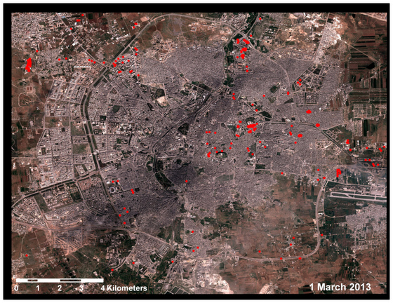
Aleppo satellite images
[click on photo for larger image]
Satellite images released by Amnesty International and featured at The Huffington Post show the scale of damage to Aleppo, Syria:
The images were taken between September 2012 and May 2013 and track individual instances of physical damage across Aleppo. An analysis of the photos by the American Association for the Advancement of Science concluded that the distribution of destroyed buildings and roads is "severely lopsided" towards opposition-held areas of the city.
READER COMMENTS: "Aleppo satellite images"