 This weekend, John Burns of the New York Times again makes the hackneyed “Iraq is Vietnam” analogy (see Shadow of Vietnam Falls Over Iraq River Raids for a prior example by Mr. Burns).
Iraq veteran Chester from The Adventures of Chester takes Mr. Burns to task for his inaccurate comparison, and notes the main reasons why the Euphrates ratline is not comparable to the Ho Chi Minh Trail used by the North Vietnamese to supply the Viet Cong. He responds that:
* The geography is wholly incomparable
* The terrain in Iraq is much more favorable to air and ground intervention, unlike to triple canopy and rough jungle that existed on the Ho Chi Minh Trail.
* The Euphrates ratline is wholly contained within Iraq.
* The ratline does not have a series of ‘branches’ – it is a single entity that extends along the Euphrates.
* There are no legal restrictions on US forces to interdict the Euphrates ratline, and international law does not prevent hot pursuit into Syria (hot pursuit has been delayed for political reasons but is not off the table).
* The scope of the Euphrates ratline is nowhere near that of the Ho Chi Minh Trail; there are no extensive facilities available to the insurgents.
* The scale (volume and nature of the materiel) passing along ratline is nothing like the quality and quantity of military equipment and entire military units that flowed along the Ho Chi Minh Trail.
Other than that, I’m sure it’s a brilliant comparison. In short, the ‘Euphrates ratline is the Ho Chi Minh Trail’ analogy is seriously flawed.
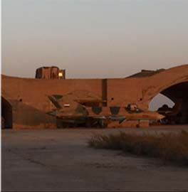
Mr. Burns may have helped his case a bit more had he mentioned the other ratlines; along Tal Afar – Mosul Axis, and Iranian border directly northeast of Baghdad (see full Iraq map over at GlobalSecurity.org); however, it would not have changed the differences in geography, law, terrain, scope and the scale that exist between the ratlines in Iraq and the Ho Chi Minh Trail in Vietnam.
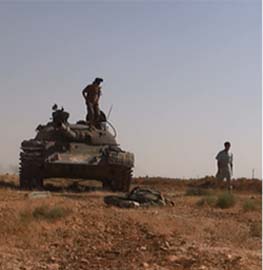
With that said, the military actions over the past year along the Euphrates River demonstrate the importance of this logistical chain. The Coalition’s focus on the Euphrates ratline indicates they believe this is the most significant and effective line of communications used by the insurgency.
Severing the Euphrates ratline appears to be more difficult than would seem by taking a simple look at a map of the region (see the excellent “A Lifeline in the Insurgency” media graphic at the New York Times article). The populated areas and main roads run along a dense corridor of the Euphrates River. There are two main roads running north and south of the river, all the way from the Syrian border to Baghdad. It would seem logical to sever the line of communication by road blocking the main roads and heavily patrolling the river at certain points. This would force the insurgency to move the ratlines to the perimeters in less dense areas, making them easier to attack and decreasing their effectiveness. Haditha (the subject of Operation New Market) looks to be a logical point, as the main roads narrow towards the river, giving a smaller area to patrol if force size is an issue.
It is unclear at this time if this has been attempted or if the Coalition is waiting for Iraqi units to participate in the action. But the ability to physically sever the Euphrates ratline was an option that never really existed with the Ho Chi Minh Trail. Perhaps the next war will provide the appropriate Vietnam template for those who long for its return, but this one does not.


1 Comment
The hitch-hiker’s guide to jihad in Iraq
Evan Kohlmann has provided a translation of a jihadi’s guide to join the Iraqi ‘resistance’ through Syria: The new road to Mesopotamia, by Al-Muhajir